
Black Canyon of the Gunnison
About Black Canyon of the Gunnison
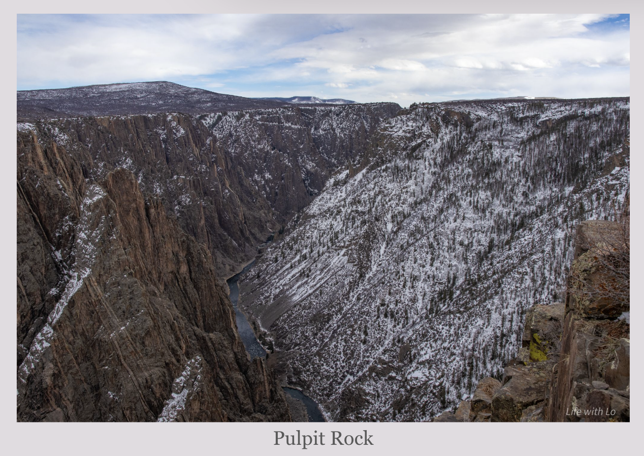
The canyon was formed from several different geologic actions. Almost 60 million years ago the ground in that area was slowly lifted up. Then around 30 million years ago there were two volcanoes that erupted, which covered up the rocks that had risen with ash. Finally around 2 million years ago the Gunnison river started flowing through that area, eroding the rock and creating the canyon we see today. The canyon depths range from 1,700 feet to 2,700 feet. At its narrowest the canyon is only 40 feet wide at the river and 1,100 feet at the rim.

What to do?
The park is split into two sections: North Rim and South Rim. There are several different hiking trails and pull-outs that you can stop at on both drives. The North rim drive is unpaved and is closed during the winter season. Due to its location it tends to be less trafficked than the South Rim drive. The road, while unpaved, is a gravel road and should be doable for most cars.
Wilderness Use Permits

For trails that head down into the canyon you are required to get a Wilderness Use Permit. You cannot obtain the permit until the day of your hike for the North rim hikes. and there are a limited amount depending on the hike. For the south rim hikes they are available at 3:30 pm the day before during the busy season. The permits can be obtained at a first come/first serve basis either at the Ranger Station or a Kiosk.

Small disclaimer here. The mileage on these hikes seem incredibly doable, but these are by no means easy hikes. You are climbing into the canyon and then back out, this means that the huge elevation gain is all completed on the second half of the hike. These are very strenuous and should not be attempted unless you are physically capable. Since this is a smaller park any medical or other assistance takes longer to reach hikers. Just incase something happens on the trail and you need to be rescued and you will be on the trail longer than expected, a ranger told us he recommends for people to bring more food and water than you think you will need.
Visiting in Winter
The North Rim Road is closed to all travel during the winter season. However, the South Rim road is open until you get to Gunnison Point, past there it is closed to car traffic. This area of the road is reserved for cross-country skiing and snowshoeing. If you chose to ski or snowshoe you can go as far as High Point, which is 6 miles down the road. There are no rentals for gear in the park. Rentals can be found in neighboring communities. I would also be sure to keep an update on the snow conditions for the park. Dan and I planned to ski the road and were constantly checking for updates on the conditions. Due to the lack of snow this winter we prepared to ski or hike this section. Snow conditions can be found on the NPS website.
There are also guided snowshoe hikes in winter typically mid-january to February. It is a 90 minute tour and about a mile is covered. Reservations can be made a week in advance by emailing. Snowshoes will be given for free to those who are on the ranger-led tour.
Make sure to bring your own water when venturing into this park in winter. There is no drinking water available during the winter season.

Where to Stay?
The closest town to the entrance for the South Rim is Montrose, Colorado. The gate to the park is only a 20 minute drive from Montrose. There are also multiple different places to stay and some great places to eat. If you want to access the North Rim road you will have to travel around the whole park before entering through Crawford, Colorado. Crawford is about an hour and a half from Montrose.

Quick Facts: